Web Soil Survey
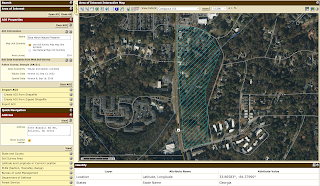
I enjoyed learning how to use the USDA's Web Soil Survey for the Blue Heron Nature Preserve. When searching for the area of interest (AOI), I initially found capturing the Blue Heron Nature Preserve difficult since the address only pinpointed the location. The Define AOI by Polygon tool allowed me to map out the Blue Heron Nature Preserve since it is an odd shape and does not appear on the map. As someone starting with WSS, figuring out where to create my AOI was difficult. Once I spent a few minutes playing around with the website, it made more sense to where to look for information.
Here is the Blue Heron Nature Preserve documented as the AOI:
Next, I utilized the Soil Map to see what soil/miscellaneous areas are in the Blue Heron Nature Preserve. When starting this project, I was nervous about the Soil Map, primarily because of my limited environmental background. The Intro to Soils page under Soil Data Explorer helped me learn about soil surveys, soil horizons, parent material, map units, and what makes up soil. The creators of this site worked hard to make this a one-stop-shop for soil surveys, making it easy to utilize as a first-timer. On each Map Unit Name, I could click into it and learn about the profile, properties, qualities, and settings. The Soil Map is a great way to understand the layout of your AOI.


Comments
Post a Comment